GEOMAN OÜ

Media page and news feed
?
Precise geodetic measurements and reliable documentation are the cornerstones of real estate projects, development and public space planning. Located knowledge

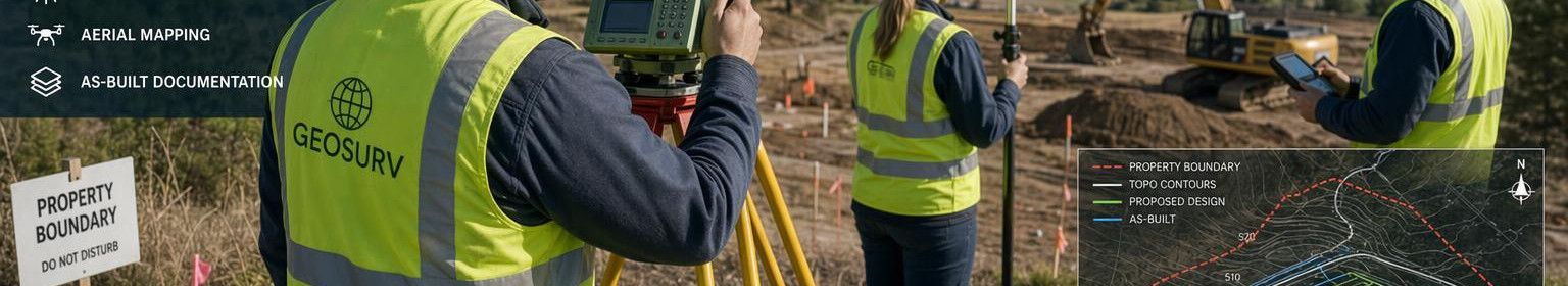
Geodetic services in Haapsalu - accurate border measurements, topographical plans and performance measurements

Precise geodetic measurements and reliable documentation are the cornerstones of real estate projects, development and public space planning. Located knowledge and modern technology border measurement, topographical plan and performance measurement ensure that decisions are based on correct data for real estate owners, developers and municipalities.

What works are carried out and to whom

Service package includes:

  • border measurement - accurate border determination and updating of cadastral metering data;
  • li>
  • rli>rstrong>topographical plan - map of the landscape height and object for planning and design;
  • l > /strong> (as-built documentation) - measurements made during construction and after construction confirming compliance with the project;
  • l> l >l> Topographic plans provide a clear overview of the properties of the ground, allowing optimisation of projects and costs. Promotion measurement ensures that the completed object meets the project and facilitates the transfer.

    Principal functions and advantages

    • Regulatory compliance: work is carried out in accordance with existing standards and legal requirements that give legal weight to the documents.
    • Registered geodetic competence: measurements and cadastral measurement are carried out under the supervision of registered professionals (MTR EEG000415; CPC No 139751), which increases reliability and quality.
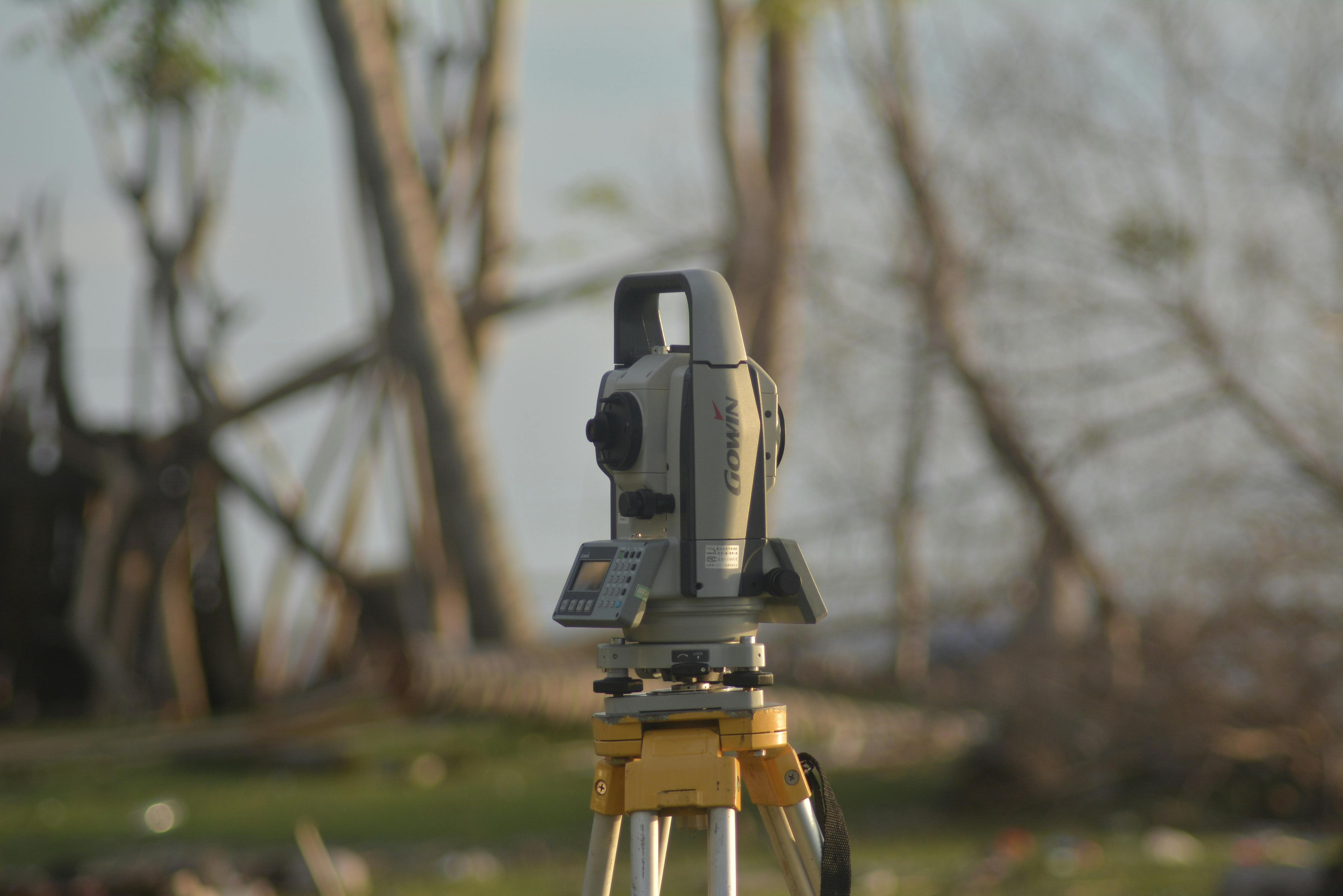
    • Principal measurement and data processing methods: fast GNSS solutions, impact or laser metering and accurate data processing processes ensure A combination of local experience, official registration and modern methods ensures that cadastral measurement, border measurement and topographical plan meet both practical and legal expectations.

      How the process works

      1. First consultation and advice: map the needs of the project and compile an appropriate set of measurements.
      2. External work: accurate GNSS and land measurement methods, necessary marking and control measurements.
      3. I>Data processing and documentation: topographical plans, catastrics and as-built drawings according to requirements.
      4. Results delivered: clear, digitally suitable documentation and, if necessary, follow-up advice for management or further steps.

      , clear measurement data and Precise border measurement, high-quality topographical plan and professional performance measurement ensure satisfaction both at the project stage and after completion of the object.

Comments (0)


Are you sure you want to delete this article?

Dropdown

all articles

Land measurement - accurate border markings and cadastral measurements to ensure legal certainty

Land measurement   The service provides accurate and officially used border measurements and cadastral measurements necessary for entry in the land register and
ssb.ee
Land measurement The service provides accurate and officially used border measurements and cadastral measurements necessary for entry in the land register and for carrying out legal transactions. Particular attention will be paid to the process of measuring land and to the installation of clear, documented boundary marks in order to avoid disputes and ensure clarity of ownership. Who benefits from this? The target group of the service is property interests, notarial institutions, real estate brokers, real estate developers, municipalities and private individuals who need reliable

Performance measurements - accurate as-built documentation and a definite check of conformity upon delivery of the construction

What does a performance measurement mean and for whom it is?   A performance measurement   provides accurate  as-built documentation  from completed buildings a
ssb.ee
What does a performance measurement mean and for whom it is? A performance measurement provides accurate as-built documentation from completed buildings and includes a thorough construction measurement and object inventory . The service is designed for architects, prime contractors, real estate owners and project engineers who need a properly documented final status for the transition and reliable conformity control with the project and existing standards. Why is this important? Determined measurements and clear as-built documentation to facilitate the transfer, reduce disputes

Topographical plans - precision that reduces design risks

Clear basis for faster decisions and more secure design    Topographic plans  provide accurate ground mapping to support design, construction preparation and pl
ssb.ee
Clear basis for faster decisions and more secure design Topographic plans provide accurate ground mapping to support design, construction preparation and planning processes. Precise terrain elevation data and documented altitudes reduce uncertainty, accelerate authorisation and allow for informed technical and financial decisions. This includes high-quality topography Detail topography plan suitable for architectural, engineering and design work. li>li>li> Earth elevation /strong> and surface information showing natural and artificial terrain formation. Highpoints

Are you sure you want to delete this article?

Loader

Loader

App Ad

Scorestorybook Chrome extension

The Storybook extension tells you which company's website you are currently on and how reliable that company is today. download extension

See the background of the caller! Storybook App brings you direct contacts for 400,000 Estonian companies and individuals (managers, officials). The data is enriched with solvency and financial information.