
The benefits of drone photogrammetry for surveying

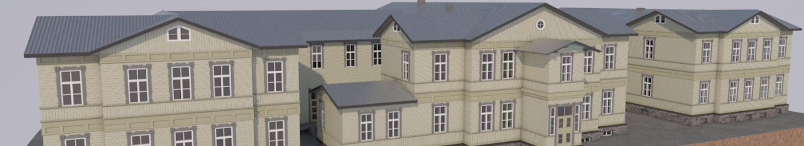
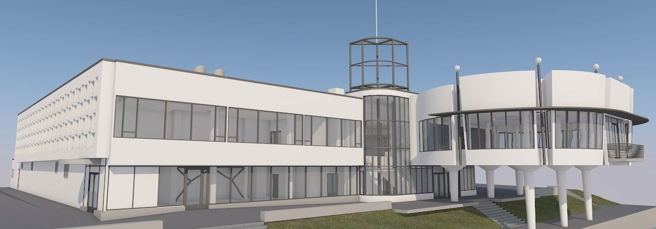
Drone photogrammetry is revolutionizing the field of surveying by providing a cutting-edge method for capturing detailed and accurate spatial data. This technology utilizes drones equipped with high-resolution cameras to capture a series of overlapping images of a survey area. These images are then processed using specialized software to create precise 3D models and maps. As a result, drone photogrammetry offers a powerful tool for professionals in architecture, engineering, construction, and real estate development, enabling them to visualize and analyze complex designs with unprecedented clarity and detail.
How Drone Photogrammetry Works
The process of drone photogrammetry begins with planning a flight path over the survey area. Drones are programmed to fly autonomously along this path, capturing high-resolution images at regular intervals. These images overlap significantly, allowing for accurate stitching and 3D reconstruction. Advanced photogrammetry software then processes the images, using algorithms to identify common points and generate a detailed 3D model or orthomosaic map. This model can be used for a variety of applications, from topographic surveys to volumetric calculations.
Key Benefits of Drone Photogrammetry for Surveying
One of the most significant advantages of drone photogrammetry is its ability to deliver highly accurate and precise data. The high-resolution cameras and sophisticated software ensure that the resulting 3D models and maps are detailed and reliable, reducing the margin of error in measurements and analyses. This level of accuracy is crucial for professionals who require precise data for planning and decision-making.
Traditional surveying methods can be time-consuming and costly, often requiring extensive manpower and equipment. In contrast, drone photogrammetry significantly reduces the time and resources needed to complete a survey. Drones can cover large areas quickly and efficiently, capturing data in a fraction of the time it would take using conventional methods. This efficiency translates into cost savings, making drone photogrammetry an attractive option for budget-conscious projects.
Surveying can often involve working in hazardous environments, such as construction sites or rugged terrains. Drones eliminate the need for surveyors to physically access these areas, reducing the risk of accidents and injuries. By keeping personnel out of harm's way, drone photogrammetry enhances safety while still delivering high-quality data.
Drones equipped with photogrammetry technology can capture a wealth of data in a single flight. This includes not only high-resolution images but also information on elevation, volume, and surface area. The comprehensive nature of this data allows for more informed decision-making and better project outcomes, as professionals can analyze multiple aspects of a site simultaneously.
Drone photogrammetry is a versatile tool that can be adapted to a wide range of surveying applications. Whether it's mapping a construction site, assessing environmental changes, or planning urban developments, drones can be customized to meet the specific needs of a project. This flexibility makes them an invaluable asset for professionals seeking innovative solutions to complex challenges.
Applications of Drone Photogrammetry in Surveying
In the construction industry, drone photogrammetry is used to monitor progress, assess site conditions, and ensure compliance with design specifications. The ability to generate accurate 3D models and maps allows project managers to visualize and plan construction activities more effectively, reducing delays and improving efficiency.
Real estate developers and urban planners benefit from drone photogrammetry by gaining a comprehensive view of potential development sites. The detailed data provided by drones aids in site selection, design planning, and impact assessments, ensuring that projects are both feasible and sustainable.
Drones are increasingly used for environmental monitoring, providing valuable insights into land use changes, vegetation health, and natural resource management. The ability to capture high-resolution data over large areas makes drone photogrammetry an essential tool for environmental scientists and conservationists.
In the mining industry, drone photogrammetry is used for volumetric calculations, pit mapping, and monitoring of stockpiles. The accurate data provided by drones helps mining companies optimize operations, improve safety, and reduce environmental impact.
Future Trends in Drone Photogrammetry
As technology continues to advance, the capabilities of drone photogrammetry are expected to expand even further. Innovations such as artificial intelligence, machine learning, and improved sensor technology will enhance the accuracy and efficiency of data collection and analysis. These advancements will open up new possibilities for professionals in surveying and related fields, offering even greater opportunities to streamline workflows and improve project outcomes.


Comments (0)