

The Company Story

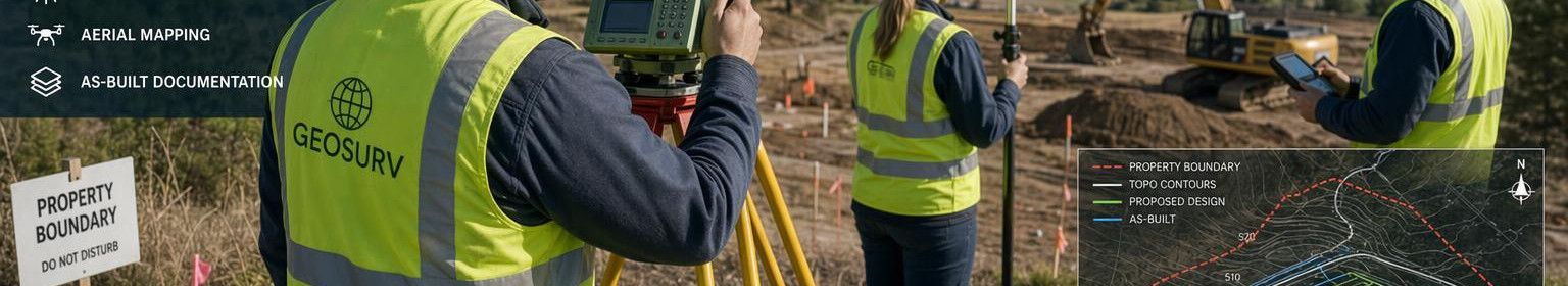
Our company offers professional geodesy and land measurement services to Haapsalu, Läänemaa and Hiiumaa communities, which focus on accuracy, legal compliance and practical usability. We work to ensure that landowners, project managers and public administration receive reliable and documented information as the basis for their decisions.
Many project and land-use processes depend on clear boundaries, correct baseline data and validated performance documentation. We take on tasks where it is necessary to confirm borders, prepare geodetic and topographical base plans or document finished buildings for both design, permit applications and final acts.
We work on a project-by-project basis and provide services that support both private and public needs: land parcel documentation, geodetic base plans, topographical data and performance measurements and land-use planning work. The results of our work are intended to be a direct support for designers, builders, owners and administrators, not just as a technical output.
What customers want to trust us with will benefit from long-term practical experience since 1996, local response capacity and official MTR register certificate (MTR reg). No EEG000415. Our goal is to be a practical and reliable partner to ensure accurate and legally applicable metering information to support local construction and land management.

Comments (0)