A GEO OÜ

Media page and news feed
?
Establishment geodesy and surveying work provide designers, builders and subscribers with ready-to-use basic data for each stage of construction. The service co

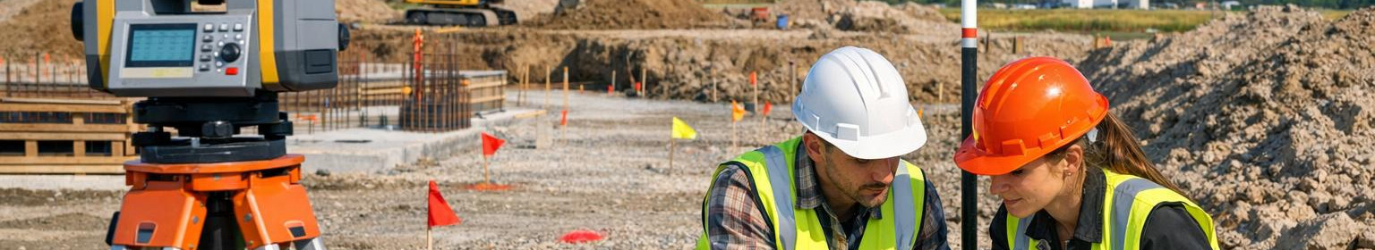
Construction geodesy: accurate topographic surveys, as-built and base plans

Establishment geodesy and surveying work provide designers, builders and subscribers with ready-to-use basic data for each stage of construction. The service combines topographic measurements, as-build measurements, as-build measurements, basic planning and control point management, so that all measurements meet project requirements and are quickly integrated into project information systems.

Main functions and advantages

  • , /strong> - detailed ground and existing objects modelling supporting the initial stage of design and risk assessment.
  • l >l >l >l > As-build measurements - accurate final measurements after construction steps, documented in accordance with standards and transfer requirements.l >l >/l >l >l >l >rl >/l >l >l > Correct base plans and as-built documentation provide a clear basis for decision-making, procurement and final review. The geodesy of construction helps to protect the budget and the timetable by ensuring that the project meets both technical and regulatory requirements.

    How the process works

    1. The beginning of the project: mapping of needs and range of measurements - is determined by the network and logistics of checkpoints.
    2. External works: topographic measurements in the landscape and mapping of existing structures.
    3. /li>/li>/h2>Differences that count at the end of the construction stages to document the actual situation compared to the project.li>Determination of data processing: basic plans and geospatial models according to the format of the subscribers.
    4. : final documentation, measurement reports and reports of checkpoint The qualified team shall plan the location of the inspection posts in such a way that the measurements are repeated and audited. The digital availability of data allows for smooth integration into design software and building management systems.

      At the end, clear and verified base plans, accurate as-built records and a reliable control point network will be completed - all necessary components for smooth construction work and successful completion of the project.

      Ask for free consultation and price offer - a quick overview of the measurement needs and an adapted solution that will keep time, money and risks.

Comments (0)


Are you sure you want to delete this article?

Dropdown

all articles

Topographic surveying - accurate base plans, landscape model and surface surveying for design certainty

Topographic surveying  provides a clear and reliable overview of the terrain elevation and the existing object conditions supporting design, construction and pl
ssb.ee
Topographic surveying provides a clear and reliable overview of the terrain elevation and the existing object conditions supporting design, construction and planning. Precise base plans , ready to calculate landscape model and structured surface measurement data allow informed decisions, reduce risks and accelerate project implementation. For whom? Services suitable for architects, designers, engineers, real estate developers, municipalities and construction companies – for anyone who needs accurate spatial data base for planning, coordination and documentation. What solutions

Construction geodesy: precise layout and reliable object identification

Establishment geodesy  ensures that project drawings are applied accurately and efficiently to the workplaces. Professional  location  , correct  location   and
ssb.ee
Establishment geodesy ensures that project drawings are applied accurately and efficiently to the workplaces. Professional location , correct location and methodological location reduce errors, speed up construction works and protect the quality and budget of the project as a whole. Who benefits from this? The services are intended for developers, prime contractors, civil engineers and architects who require precision and streamlined work processes. Suitable for both new constructions and renovation works, where each dimension and point counts. Why choose exact geodesy?

Precise as-built measurements and reliable delivery documentation at the end of the construction phase

Perfect inspection and clear overview of the completed object     As-built survey  provides accurate and reliable measurement data of the completed building, ma
ssb.ee
Perfect inspection and clear overview of the completed object As-built survey provides accurate and reliable measurement data of the completed building, making transfer, monitoring and future administration simple and auditable. Properly located control points and standardised transfer documentation ensure that the object documentation meets the requirements and is directly available for project management and BIM/GIS integration. What is as-built measurement? As-built measurement means accurate geodetic or 3D documentation of the completed building, infrastructure or engineering

Are you sure you want to delete this article?

Loader

Loader

App Ad

Scorestorybook Chrome extension

The Storybook extension tells you which company's website you are currently on and how reliable that company is today. download extension

See the background of the caller! Storybook App brings you direct contacts for 400,000 Estonian companies and individuals (managers, officials). The data is enriched with solvency and financial information.