

A GEO OÜ
Media page and news feed
?
Business media page visits - 2637; followers - 17. Reviews - 2; Articles 6+ "Write an opinion on A GEO OÜ!"
ageo.ee
Featured Image
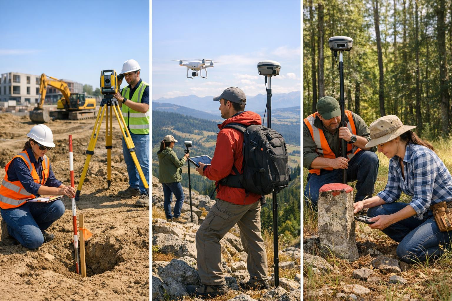
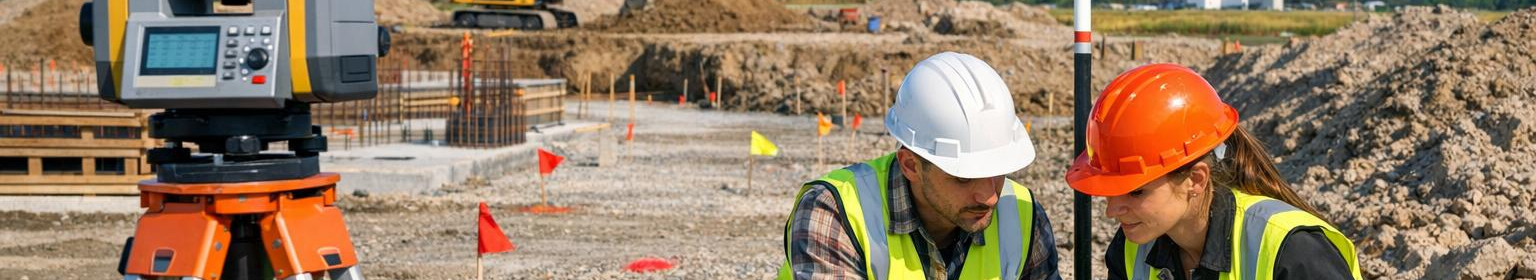
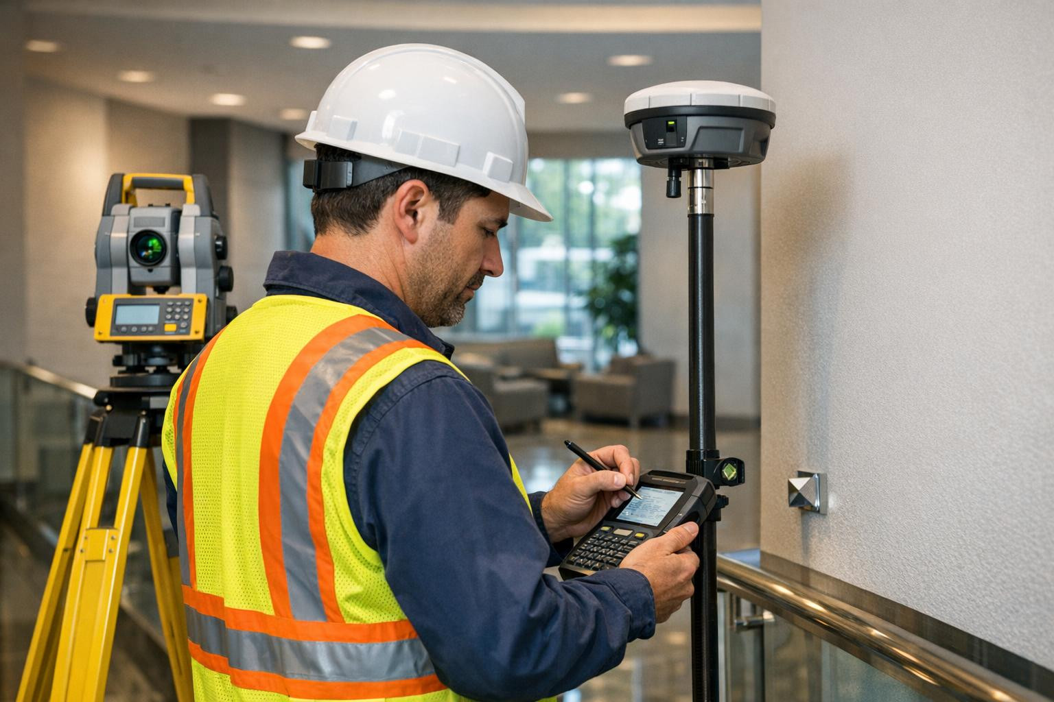
Geodesy and surveying
We offer a complete geodesy and surveying service from the beginning of construction projects to the transfer, combining construction marking, topographic modelling and as-built documentation. We ensure accurate measurements, consistency with project requirements and ready-to-use basic data for architects, engineers and subscribers.
construction geodesy
topographic mapping
as-built mapping
Basic plans
checkpoints
ageo.ee
Featured Image
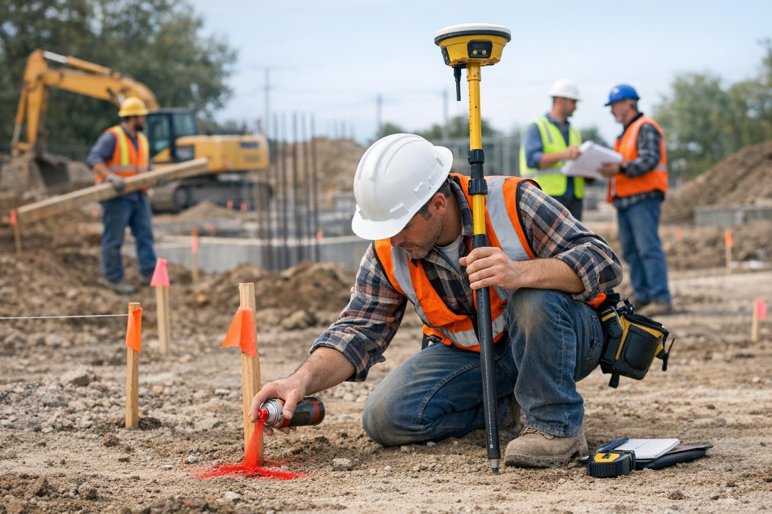
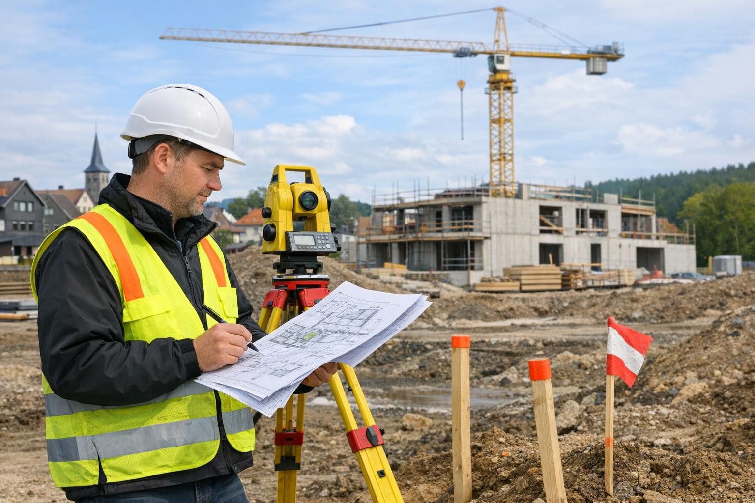
Geodesy of construction
construction geodesy
placement work
designation of the object
marking
ageo.ee
Featured Image
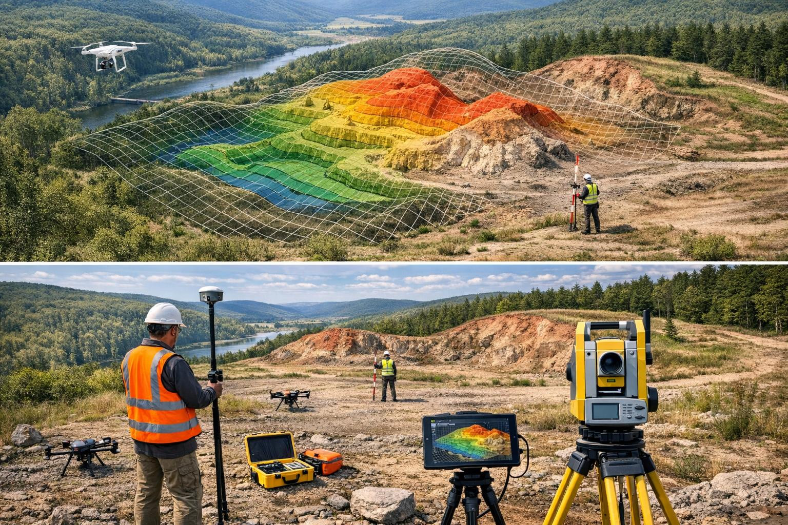
Topographic mapping
topographic mapping
landscape model
Basic plans
Surface measurement
ageo.ee
Featured Image
As-built mapping
as-built mapping
checkpoints
transfer documentation
documentation of the object
Our company story
?
Company management, team and contacts
The Company Story

Our aim is to ensure reliable spatial information for construction and rural development projects, which allows decisions to be made in a precise and timely manner. We work mainly in Tallinn and Harju County, offering local survey services on which project managers, architects and owners can rely.
Many projects face measurement-based inconsistencies: inaccurate data can lead to repetitions, delays and difficulties with registration or lime processes. Reducing such risks requires clear, verified and compliant measurement documentation.
Our approach is practical and work-oriented: we create a basis for spatial data supporting projects, validate the necessary measurement networks in the field and document readiness and compliance for both designers and contracting authorities. Services will be delivered on a project-by-project basis and according to the client's schedules.
We are a company with local background and long-term experience (registered in Estonia in 2000), which ensures direct contact and rapid response to projects in Tallinn and Harju County. We are characterised by precision, practicality and reliability - the aim is to reduce the delays caused by measurements and provide project participants with a reliable basis for decision making.
A GEO OÜ contacts
What do customers think?
?
Company customer opinions
-
Kati P.
Tegime ehitusprojekti paigutustöid nende meeskonnaga. Töö oli täpne ja suhtlus sujus, mis vähendas ehituslikke viivitusi.
-
Jaan R.
Baasplaanid ja maastikumudelid olid selged ning andsid inseneridele usaldusväärse aluse projekteerimiseks.
-
Liisa T.
As-built mõõdistuse raportid olid põhjalikud ja vastasid nõuetele; kontrollpunktide dokumentatsioon tegi üleandmise lihtsaks. Andmed on nüüd kasutusvalmis objekti halduseks.
Cooperation partners
?
The company's largest partners
Add a new partner
EE- Estonia


Dropdown

File a complaint
Choose the comment attribute that you think it contains:
You want to report an inappropriate comment.
Are you sure?
Are you sure you want to delete this article?