
Understanding construction geodetic works: a comprehensive guide

Geodesy is the science of measuring and understanding the Earth's geometric shape, orientation in space, and gravity field. In construction, geodesy is crucial for ensuring that structures are built accurately and to specification. It provides the foundational data that informs all subsequent building activities, from initial design to final construction.
Geodetic surveys are essential for obtaining precise measurements of the Earth's surface and features. These surveys help in planning construction projects, determining land boundaries, and ensuring structures are built in the correct location and orientation.
Types of Geodetic Works in Construction
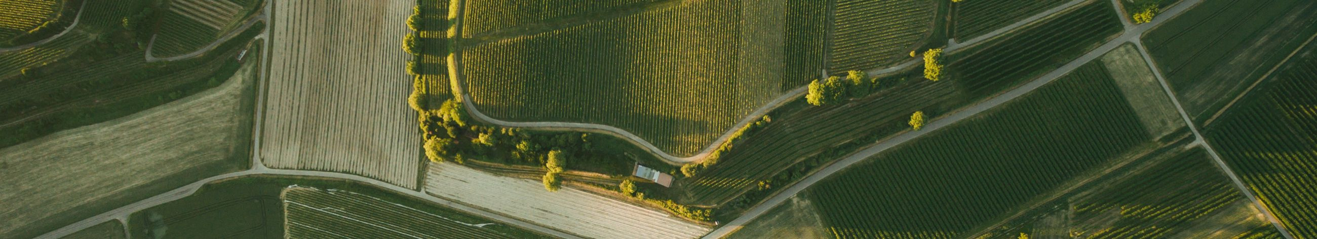
Topographic surveys involve mapping the contours, elevations, and features of a parcel of land. This type of survey is fundamental in the planning phase of construction, providing a detailed understanding of the terrain.
Boundary surveys are conducted to establish the legal property lines and corners of a parcel of land. They are critical for avoiding disputes and ensuring that construction occurs within the designated property.
Construction staking translates design plans into physical markers on the ground. These markers guide the construction of infrastructure, buildings, and other structures, ensuring they are built according to plan.
As-built surveys document the exact location, dimensions, and specifications of a completed structure. They are vital for verifying that the construction adheres to the design and for creating accurate records for future reference.
Monitoring surveys track the stability and movement of structures over time. They are essential for detecting potential issues early and ensuring the long-term safety and integrity of the construction.
Techniques and Technologies in Geodetic Works
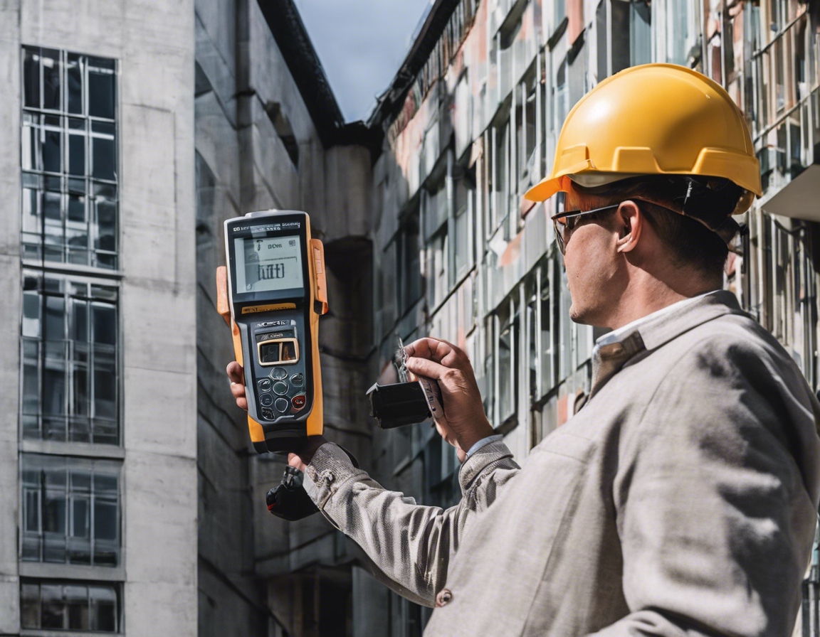
Traditional surveying instruments, such as theodolites and levels, have been used for centuries to measure angles and elevations. While still in use, they are often complemented by modern technology.
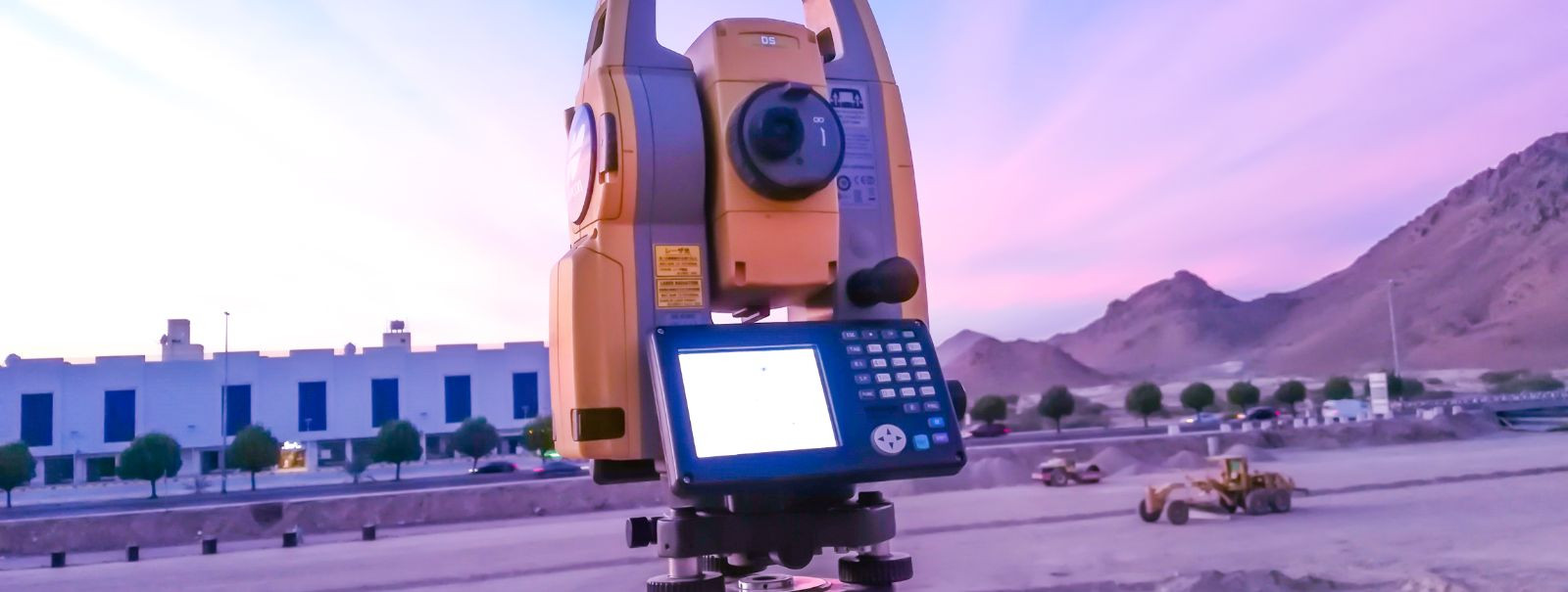
Modern instruments, including total stations and 3D laser scanners, provide faster and more accurate measurements. They have revolutionized the field of geodetic surveying in construction.
Global Positioning System (GPS) and Global Navigation Satellite System (GNSS) technologies allow for real-time, high-precision positioning. They are indispensable for large-scale and remote construction projects.
Remote sensing and photogrammetry use aerial or satellite imagery to gather data about the Earth's surface. These methods are particularly useful for large or inaccessible areas.
Geographic Information System (GIS) integration enables the management, analysis, and visualization of geospatial data. It is a powerful tool for planning and managing construction projects.
Challenges and Solutions in Construction Geodetic Works
Difficult terrain can pose significant challenges for geodetic works. Solutions include using specialized equipment and techniques to navigate and measure in these environments.
Adverse weather and environmental conditions can impact the accuracy of geodetic measurements. Employing robust equipment and timing surveys strategically can mitigate these effects.
In urban areas, existing infrastructure and space constraints can complicate geodetic works. Creative problem-solving and advanced technologies are often required to overcome these challenges.
Accuracy and precision are paramount in geodetic works. Implementing rigorous quality control measures and using high-precision instruments are essential for reliable results.
Best Practices for Effective Geodetic Works
Thorough pre-planning and site assessment are the first steps to successful geodetic works. Understanding the project requirements and site conditions ensures that the right approach and tools are used.
Effective communication and collaboration with construction teams are crucial for integrating geodetic data into the construction process. This ensures that all parties are working from the same accurate information.
The field of geodesy is constantly evolving with new technologies and methods. Professionals must engage in continuous learning and adaptation to stay at the forefront of the industry.
Meticulous quality control and comprehensive documentation are essential for ensuring the integrity of geodetic works. They provide a reliable record and accountability for all construction phases.

Comments (0)