GEOTERRA OÜ

Media page and news feed
?
A comprehensive geodesy and construction solution for faster and safer projects  A comprehensive geodesy and construction solution combines precise geodetic ser

Precise geodetic services and management of construction projects for cost-effective construction

A comprehensive geodesy and construction solution for faster and safer projects

A comprehensive geodesy and construction solution combines precise geodetic services, modern land measurement, 3D laser scanning capacity and comprehensive soil and geotechnical studies with effective construction project management. This integrated approach ensures reliable data for each construction stage, reduces risks and optimises the cost structure of the entire project.

Who benefits from it?

The service is valued by real estate and infrastructure developers, designers, construction companies, engineering offices and public sector managers who need accurate data and clear management from the initial planning to the final delivery. Suitable for smaller construction sites as well as complex large objects, where verified data and adherence to the timetable are crucial.

Why is this important?

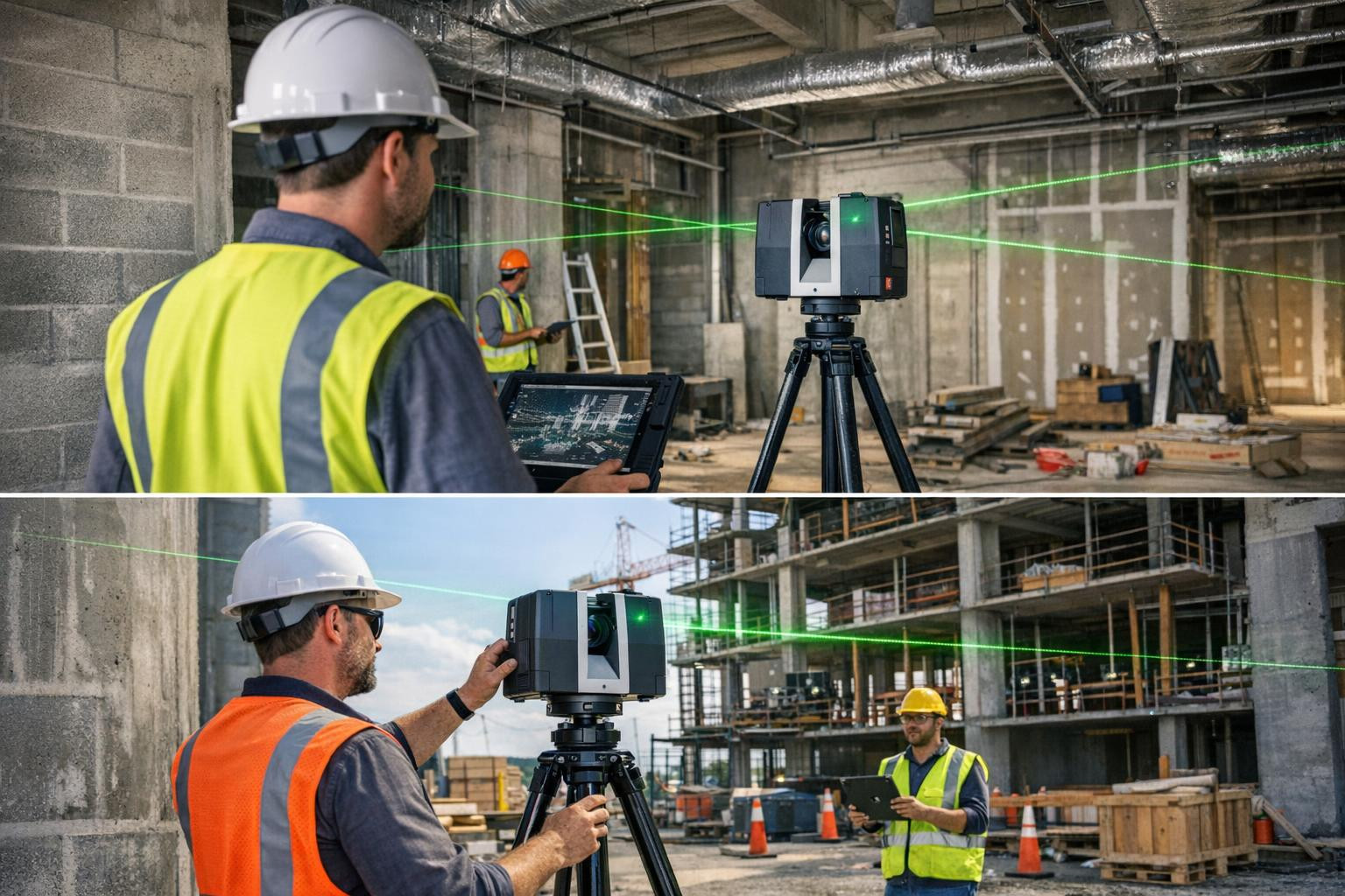
Reliable measurement results and geotechnical analyses reduce design and construction lines, prevent expensive alterations and allow for more accurate tenders. 3D laser scanning creates a model of digital topography and existing buildings that simplifies co-ordination and BIM integration, while real-time sensors and accurate land measurements ensure the correctness of the works at each stage.

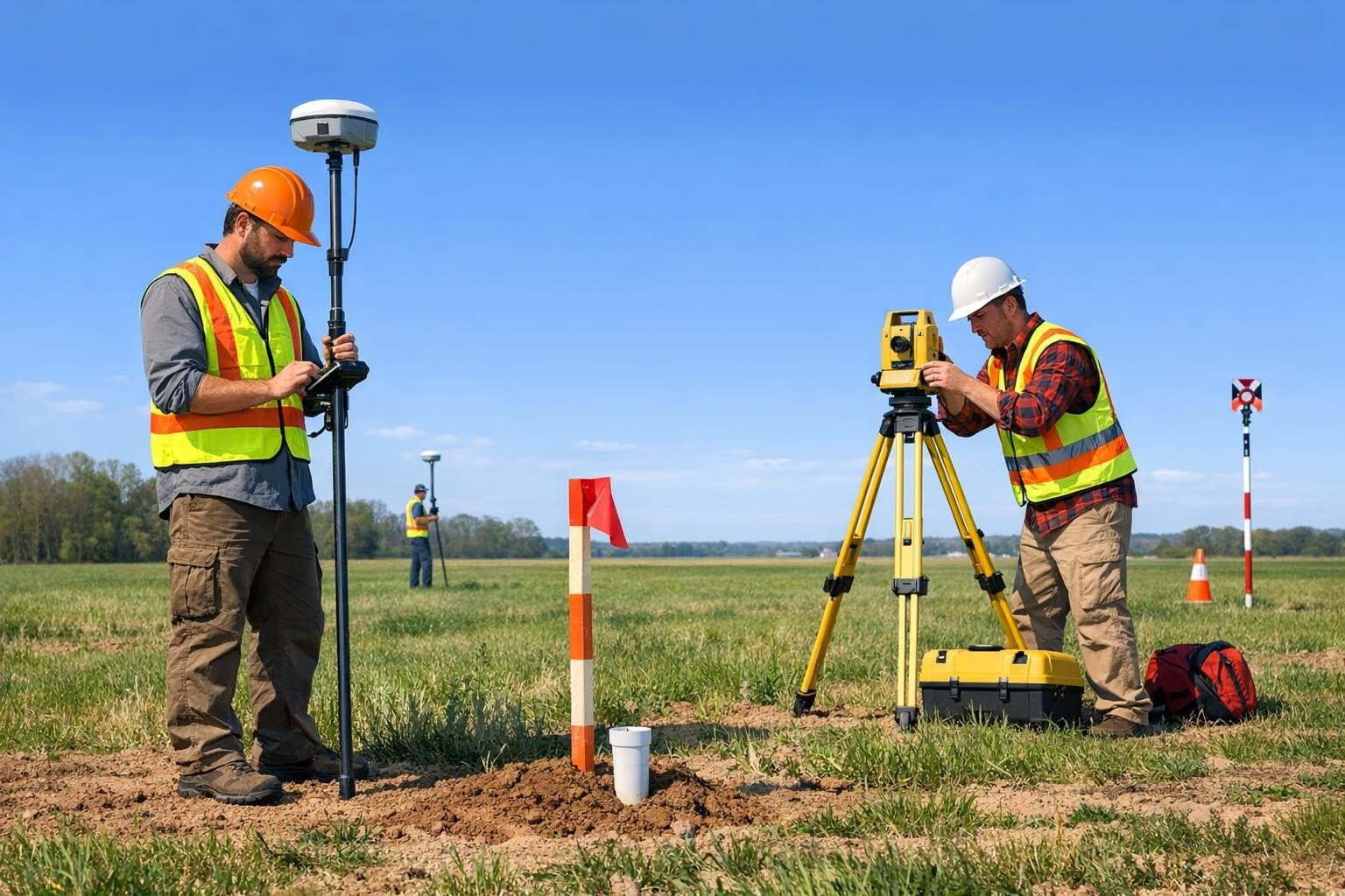
Principal functions and advantages

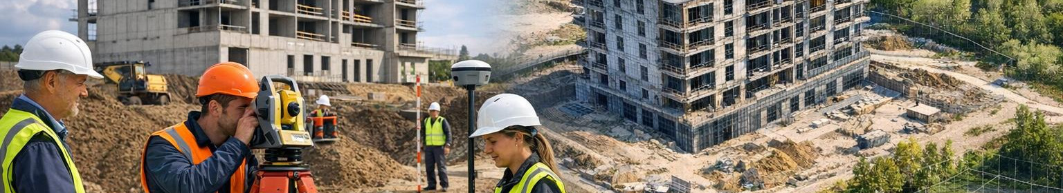
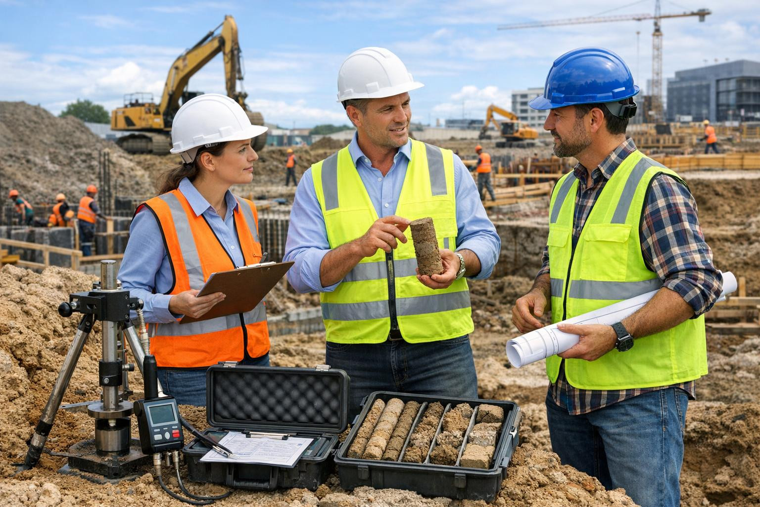
  • <Principal and geotechnical studies:Principal land measurements: GNSS and totalstation technologies ensure high accuracy of measurement data, which is the basis for further design and construction.
  • l >l >l >rl>strong >3D laser scanning: fast and detailed documentation of existing status, creation of point visual models and accurate measurement in difficult conditions l >l >l >l Certified professionals, modern equipment and industry best practice ensure stable quality and tailored solutions according to the project's specificities and budget.

    How does it work in practice?

    1. Preliminary consultation and work volume mapping: clear plan to determine the scope of measurements and studies.
    2. fieldwork and data collection: land measurement, 3D laser scanning and geotechnical studies.
    3. li>Li>Data processing and modelling: accurate reports, point clouds and BIM-compatible models. Li>Building projects management and follow-up: schedule and quality control until the transfer of the object.

    <Geodetic services with surface and geot The result is faster decisions, lower risk profile and verified costs - results that make the implementation of the project smooth.

    Contact request or consultation leads to the following step of the project: detailed plan, high-quality measurements and efficient management of construction projects, which ensure the desired result in time and budget.

Comments (0)


Are you sure you want to delete this article?

Dropdown

all articles

Secure and efficient construction management: integrated soil and geotechnical studies

Building management , where soil and geotechnical studies are integrated early and smoothly, reduces risks, accelerates works and controls costs throughout the
ssb.ee
Building management , where soil and geotechnical studies are integrated early and smoothly, reduces risks, accelerates works and controls costs throughout the project. This approach provides a solid basis for both smaller construction works and more complex infrastructure projects. Who is suitable for The target group of the service is contracting and developers who want to mitigate construction risks, teams involved in the management of construction projects looking for reliable geotechnical support, and subcontractors for whom the smooth planning and efficient execution of the works is

Accuracy and velocity: 3D laser scanning for post-construction as-built measurements

What is 3D laser scanning and why it counts    < 3D laser scanning  creates a high-resolution, three-dimensional point-world of buildings and structures, mak
ssb.ee
What is 3D laser scanning and why it counts < 3D laser scanning creates a high-resolution, three-dimensional point-world of buildings and structures, making complex details accurately measurable and digitally processable. The service is suitable for both new buildings and renovated objects, bringing clarity to project management, quality control and documentation. Who will benefit most from this service Architects, designers, engineers, prime contractors, developers of real estate, managers of renovation works and specialists of owner supervision. The exact digitisation of cultural

Land surveying service: precise land borders, reliable maps and risk-free planning

Precise land measurement   is the basis for the success of projects - from real estate transactions to construction and landscape design. The geodetic services
ssb.ee
Precise land measurement is the basis for the success of projects - from real estate transactions to construction and landscape design. The geodetic services offered provide clear land boundaries, high-quality topocards and a reliable spatial basis for each decision, reducing legal and structural risks. What is land measurement and for whom it suits? Land measurement includes accurate measurement of land and properties, topographical data collection and the fixing of borders as official catastrophes. The service is suitable for: for private and business customers who need to set

Are you sure you want to delete this article?

Loader

Loader

App Ad

Scorestorybook Chrome extension

The Storybook extension tells you which company's website you are currently on and how reliable that company is today. download extension

See the background of the caller! Storybook App brings you direct contacts for 400,000 Estonian companies and individuals (managers, officials). The data is enriched with solvency and financial information.